West Kameng District Population, Caste, Religion Data (Arunachal Pradesh) - Census 2011
West Kameng district of Arunachal Pradesh has a total population of 83,947 as per the Census 2011. Out of which 46,155 are males while 37,792 are females. In 2011 there were a total 18,159 families residing in West Kameng district. The Average Sex Ratio of West Kameng district is 819.
As per Census 2011 out of total population, 19% people live in Urban areas while 81% live in the Rural areas. The average literacy rate in urban areas is 78.2% while that in rural areas is 64.4%. Also the Sex Ratio of Urban areas in West Kameng district is 909 while that of Rural areas is 799.
The population of Children of age 0-6 years in West Kameng district is 11643 which is 14% of the total population. There are 5900 male children and 5743 female children between the age 0-6 years. Thus as per the Census 2011 the Child Sex Ratio of West Kameng is 973 which is greater than Average Sex Ratio (819) of West Kameng district.
The total literacy rate of West Kameng district is 67.07%. The male literacy rate is 64.06% and the female literacy rate is 50.08% in West Kameng district.
To facilitate the administration, West Kameng district is further divided into 13 Circles (Taluka/Tehsil/Tahsil) which are administrative divisions denoting sub-districts. Circles consists of multiple villages and a few towns.
West Kameng Data as per Census 2011
As per the Population Census 2011 data, following are some quick facts about West Kameng district.
| Total | Male | Female | |
|---|---|---|---|
| Children (Age 0-6) | 11,643 | 5,900 | 5,743 |
| Literacy | 67.07% | 64.06% | 50.08% |
| Scheduled Caste | 0 | 0 | 0 |
| Scheduled Tribe | 46,380 | 22,771 | 23,609 |
| Illiterate | 35,455 | 16,589 | 18,866 |
Caste-wise Population - West Kameng district
Schedule Caste (SC) constitutes 0% while Schedule Tribe (ST) were 55.2% of total population in West Kameng district of Arunachal Pradesh.
| Total | Male | Female | |
|---|---|---|---|
| Schedule Caste | 0 | 0 | 0 |
| Schedule Tribe | 46,380 | 22,771 | 23,609 |
Religion-wise Population - West Kameng district
| Religion | Total | Male | Female | |
|---|---|---|---|---|
| Hindu | 31,265 | (37.24%) | 19,586 | 11,679 |
| Muslim | 1,970 | (2.35%) | 1,337 | 633 |
| Christian | 8,466 | (10.08%) | 4,211 | 4,255 |
| Sikh | 328 | (0.39%) | 252 | 76 |
| Buddhist | 36,087 | (42.99%) | 17,801 | 18,286 |
| Jain | 71 | (0.08%) | 39 | 32 |
| Other Religion | 5,556 | (6.62%) | 2,823 | 2,733 |
| No Religion Specified | 204 | (0.24%) | 106 | 98 |
Literacy Rate - West Kameng district
The total literacy rate of West Kameng district was 67.07% in 2011 which is greater than average literacy rate 65.38% of Arunachal Pradesh. Population-wise, out of total 48,492 literates, males were 29,566 while females were 18,926. Also the male literacy rate was 73.45% and the female literacy rate was 59.05% in West Kameng district.
| West Kameng district | Arunachal Pradesh | |
|---|---|---|
| Female | 59.05% | 57.7% |
| Male | 73.45% | 72.55% |
| Total | 67.07% | 65.38% |
Sex Ratio - West Kameng district
The Sex Ratio of West Kameng district is 819 . Thus for every 1000 men there were 819 females in West Kameng district. Also as per Census 2011, the Child Sex Ration was 973 which is greater than Average Sex Ratio ( 819 ) of West Kameng district.
Population Density - West Kameng district
The total area of West Kameng district is 7,422 km2. Thus the density of West Kameng district is 11 people per square kilometer. As per the initial provisional data of Census 2011, around 0 sq. km. area is under urban region while 0 sq. km. is under rural region.
Urban/Rural Population - West Kameng district
As per the Census 2011 out of total population of West Kameng, 18.98% people lived in urban regions while 81.02% in rural areas. The total urban population was 15,932 out of which 8,346 were males while the remaining 7,586 were females. In rural areas of West Kameng, male population was 37,809 while the female population was 30,206.
The average sex ratio in urban regions of West Kameng was 909 females per 1000 males. Also the Child (0-6 age) sex ration of urban areas in West Kameng was 1,008 girls per 1000 boys. Thus the total children (0-6 age) living in urban areas of West Kameng were 1,831 which is 11.49% of total urban population. Similarly the average sex ratio in rural areas of West Kameng was 799 females per 1000 males. The Child sex ratio of rural areas in West Kameng was 967 girls per 1000 boys.
The average literacy rate in West Kameng for urban regions was 78.21 percent in which males were 83.58% literate while female literacy stood at 72.24%. The total literate population of West Kameng was 48,492. Similarly in rural areas of West Kameng, the average literacy rate was 64.37 percent. Out of which the literacy rate of males and females stood at 71.15% and 55.59% respectively. Total literates in rural areas of West Kameng were 37,463.
| Rural | Urban | |
|---|---|---|
| Population % | 81.02% | 18.98% |
| Total population | 68,015 | 15,932 |
| Male population | 37,809 | 8,346 |
| Female population | 30,206 | 7,586 |
| Sex ratio | 799 | 909 |
| Child sex ratio (0-6 age) | 967 | 1,008 |
| Child population | 9,812 | 1,831 |
| Literates | 37,463 | 11,029 |
| Average literacy | 64.37% | 78.21% |
| Male literacy | 71.15% | 83.58% |
| Female literacy | 55.59% | 72.24% |
Child Population - West Kameng district
According to Census 2011, there were 11,643 children between age 0 to 6 years in West Kameng district. Out of which 5,900 were male while 5,743 were female.
Working Population - West Kameng district
In West Kameng district out of total population, 42,493 were engaged in work activities. 81.8% of workers describe their work as Main Work (Employment or Earning more than 6 Months) while 18.2% were involved in Marginal activity providing livelihood for less than 6 months. Of 42,493 workers engaged in Main Work, 11,331 were cultivators (owner or co-owner) while 817 were Agricultural labourers.
| Total | Male | Female | |
|---|---|---|---|
| Main Workers | 34,752 | 24,640 | 10,112 |
| Cultivators | 11,331 | 5,884 | 5,447 |
| Agriculture Labourer | 817 | 507 | 310 |
| Household Industries | 458 | 194 | 264 |
| Other Workers | 22,146 | 18,055 | 4,091 |
| Marginal Workers | 7,741 | 3,673 | 4,068 |
| Non Working | 41,454 | 17,842 | 23,612 |
Nearby Districts from West Kameng
Below are the list of Districts near West Kameng district in Arunachal Pradesh.
| District | Population |
|---|---|
| East Kameng district population | 78,690 |
| Tawang district population | 49,977 |
| Papum Pare district population | 176,573 |
| Upper Subansiri district population | 83,448 |
| West Siang district population | 112,274 |
| East Siang district population | 99,214 |
| Upper Siang district population | 35,320 |
| Changlang district population | 148,226 |
| Tirap district population | 111,975 |
| Lower Subansiri district population | 83,030 |
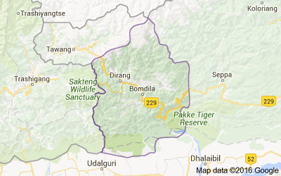
West Kameng district Map
Reference
- Census 2011 Data - censusindia.gov.in
- West Kameng, Arunachal Pradesh - Wikipedia