Hyderabad District Population, Caste, Religion Data (Andhra Pradesh) - Census 2011
Hyderabad district of Andhra Pradesh has a total population of 3,943,323 as per the Census 2011. Out of which 2,018,575 are males while 1,924,748 are females. In 2011 there were a total 849,051 families residing in Hyderabad district. The Average Sex Ratio of Hyderabad district is 954.
As per Census 2011 out of total population, 100% people live in Urban areas while 0% live in the Rural areas. The average literacy rate in urban areas is 83.2% while that in rural areas is NaN%. Also the Sex Ratio of Urban areas in Hyderabad district is 954 while that of Rural areas is NaN.
The population of Children of age 0-6 years in Hyderabad district is 469126 which is 12% of the total population. There are 245127 male children and 223999 female children between the age 0-6 years. Thus as per the Census 2011 the Child Sex Ratio of Hyderabad is 914 which is less than Average Sex Ratio (954) of Hyderabad district.
The total literacy rate of Hyderabad district is 83.25%. The male literacy rate is 76.42% and the female literacy rate is 70.11% in Hyderabad district.
To facilitate the administration, Hyderabad district is further divided into 16 Mandals (Taluka/Tehsil/Tahsil) which are administrative divisions denoting sub-districts. Mandals consists of multiple villages and a few towns.
Hyderabad Data as per Census 2011
As per the Population Census 2011 data, following are some quick facts about Hyderabad district.
| Total | Male | Female | |
|---|---|---|---|
| Children (Age 0-6) | 469,126 | 245,127 | 223,999 |
| Literacy | 83.25% | 76.42% | 70.11% |
| Scheduled Caste | 247,927 | 124,313 | 123,614 |
| Scheduled Tribe | 48,937 | 25,556 | 23,381 |
| Illiterate | 1,051,168 | 475,887 | 575,281 |
Caste-wise Population - Hyderabad district
Schedule Caste (SC) constitutes 6.3% while Schedule Tribe (ST) were 1.2% of total population in Hyderabad district of Andhra Pradesh.
| Total | Male | Female | |
|---|---|---|---|
| Schedule Caste | 247,927 | 124,313 | 123,614 |
| Schedule Tribe | 48,937 | 25,556 | 23,381 |
Religion-wise Population - Hyderabad district
| Religion | Total | Male | Female | |
|---|---|---|---|---|
| Hindu | 2,046,051 | (51.89%) | 1,046,624 | 999,427 |
| Muslim | 1,713,405 | (43.45%) | 880,127 | 833,278 |
| Christian | 87,522 | (2.22%) | 43,291 | 44,231 |
| Sikh | 11,446 | (0.29%) | 6,005 | 5,441 |
| Buddhist | 1,268 | (0.03%) | 695 | 573 |
| Jain | 19,560 | (0.5%) | 9,922 | 9,638 |
| Other Religion | 1,929 | (0.05%) | 976 | 953 |
| No Religion Specified | 62,142 | (1.58%) | 30,935 | 31,207 |
Literacy Rate - Hyderabad district
The total literacy rate of Hyderabad district was 83.25% in 2011 which is greater than average literacy rate 67.02% of Andhra Pradesh. Population-wise, out of total 2,892,155 literates, males were 1,542,688 while females were 1,349,467. Also the male literacy rate was 86.99% and the female literacy rate was 79.35% in Hyderabad district.
| Hyderabad district | Andhra Pradesh | |
|---|---|---|
| Female | 79.35% | 59.15% |
| Male | 86.99% | 74.88% |
| Total | 83.25% | 67.02% |
Sex Ratio - Hyderabad district
The Sex Ratio of Hyderabad district is 954 . Thus for every 1000 men there were 954 females in Hyderabad district. Also as per Census 2011, the Child Sex Ration was 914 which is less than Average Sex Ratio ( 954 ) of Hyderabad district.
Population Density - Hyderabad district
The total area of Hyderabad district is 217 km2. Thus the density of Hyderabad district is 18,172 people per square kilometer. As per the initial provisional data of Census 2011, around 217 sq. km. area is under urban region while 0 sq. km. is under rural region.
Urban/Rural Population - Hyderabad district
As per the Census 2011 out of total population of Hyderabad, 100% people lived in urban regions while 0% in rural areas. The total urban population was 3,943,323 out of which 2,018,575 were males while the remaining 1,924,748 were females. In rural areas of Hyderabad, male population was 0 while the female population was 0.
The average sex ratio in urban regions of Hyderabad was 954 females per 1000 males. Also the Child (0-6 age) sex ration of urban areas in Hyderabad was 914 girls per 1000 boys. Thus the total children (0-6 age) living in urban areas of Hyderabad were 469,126 which is 11.9% of total urban population. Similarly the average sex ratio in rural areas of Hyderabad was NaN females per 1000 males. The Child sex ratio of rural areas in Hyderabad was NaN girls per 1000 boys.
The average literacy rate in Hyderabad for urban regions was 83.25 percent in which males were 86.99% literate while female literacy stood at 79.35%. The total literate population of Hyderabad was 2,892,155. Similarly in rural areas of Hyderabad, the average literacy rate was NaN percent. Out of which the literacy rate of males and females stood at NaN% and NaN% respectively. Total literates in rural areas of Hyderabad were 0.
| Rural | Urban | |
|---|---|---|
| Population % | 0% | 100% |
| Total population | 0 | 3,943,323 |
| Male population | 0 | 2,018,575 |
| Female population | 0 | 1,924,748 |
| Sex ratio | NaN | 954 |
| Child sex ratio (0-6 age) | NaN | 914 |
| Child population | 0 | 469,126 |
| Literates | 0 | 2,892,155 |
| Average literacy | NaN% | 83.25% |
| Male literacy | NaN% | 86.99% |
| Female literacy | NaN% | 79.35% |
Child Population - Hyderabad district
According to Census 2011, there were 469,126 children between age 0 to 6 years in Hyderabad district. Out of which 245,127 were male while 223,999 were female.
Working Population - Hyderabad district
In Hyderabad district out of total population, 1,413,297 were engaged in work activities. 77.6% of workers describe their work as Main Work (Employment or Earning more than 6 Months) while 22.4% were involved in Marginal activity providing livelihood for less than 6 months. Of 1,413,297 workers engaged in Main Work, 14,693 were cultivators (owner or co-owner) while 16,751 were Agricultural labourers.
| Total | Male | Female | |
|---|---|---|---|
| Main Workers | 1,096,081 | 861,130 | 234,951 |
| Cultivators | 14,693 | 9,034 | 5,659 |
| Agriculture Labourer | 16,751 | 10,946 | 5,805 |
| Household Industries | 32,500 | 21,401 | 11,099 |
| Other Workers | 1,032,137 | 819,749 | 212,388 |
| Marginal Workers | 317,216 | 184,455 | 132,761 |
| Non Working | 2,530,026 | 972,990 | 1,557,036 |
Nearby Districts from Hyderabad
Below are the list of Districts near Hyderabad district in Andhra Pradesh.
| District | Population |
|---|---|
| Rangareddy district population | 5,296,741 |
| Medak district population | 3,033,288 |
| Mahbubnagar district population | 4,053,028 |
| Karimnagar district population | 3,776,269 |
| Nalgonda district population | 3,488,809 |
| Nizamabad district population | 2,551,335 |
| Warangal district population | 3,512,576 |
| Adilabad district population | 2,741,239 |
| Khammam district population | 2,797,370 |
| Srikakulam district population | 2,703,114 |
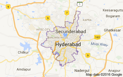
Hyderabad district Map
Reference
- Census 2011 Data - censusindia.gov.in
- Hyderabad, Andhra Pradesh - Wikipedia